
By Dan Buckler, DNR Urban Forest Assessment Specialist based in Madison, daniel.buckler@wisconsin.gov or 608-445-4578
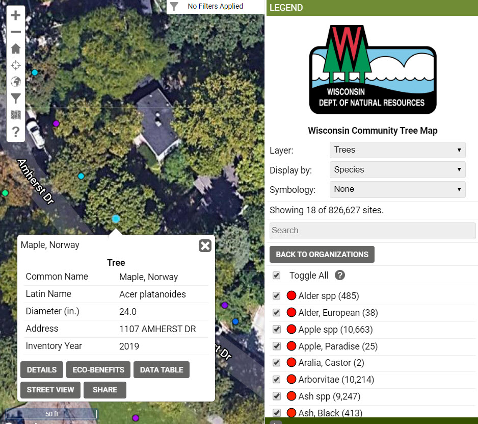
Do you have a tree inventory but have had a hard time keeping it current? The Wisconsin Department of Natural Resources (DNR) maintains the Wisconsin Community Tree Map, a compilation of tree inventories from around the state. The map shows where trees are located in different communities and includes information about each tree, such as diameter, health condition and street address.
The DNR recently acquired a few extra accounts to distribute to communities on a pilot basis. We would like to distribute these accounts to communities that would make use of the tree map functionality and actively use the tool to add or remove trees in the inventory or to edit current data (e.g. change the diameter, mark the tree as pruned). If you already have a tree inventory tool that you use and like, then this option is probably not for you. But if you don’t have a tool, then you might be interested in this free account. It could be accessed with a smart phone, tablet or computer, provided there is an internet connection. The DNR can help provide training on the tool for interested communities.
The account would be freely available through June 2021. It is unknown if the DNR will continue to fund community accounts after that, but the updated data could be exported and used elsewhere, or communities could pay for an account. The data would stay on the tree map regardless.
Interested in an account? Please reach out to Dan Buckler at daniel.buckler@wisconsin.gov.