
By Dan Buckler, DNR Urban Forest Assessment Specialist based in Madison, daniel.buckler@wisconsin.gov or 608-445-4578
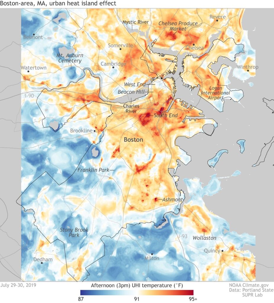
A sample map produced from the urban heat island mapping project in Boston MA
It’s too darn hot.
It’s a phrase that will be heard more and more as the Earth warms. But for those who live in cities, where the concentration of concrete and asphalt absorbs and radiates heat, it’s a familiar refrain.
Because of the dire effects of heat stress and other heat-related conditions, the importance of understanding temperature distributions in communities is extremely important. To help in that undertaking, a national public-private partnership has been working with community groups to map and analyze heat data.
This effort, led by the National Oceanic and Atmospheric Administration (NOAA) and CAPA Strategies, uses local citizen scientists to collect temperature data in their communities on one of the hottest days of the year, doing so by driving or cycling predetermined routes with monitoring equipment. CAPA Strategies then compiles, analyzes and reports out the data for community use. Previous studies of urban heat islands have shown strong relationships between cooler temperatures and more trees, which cool their surroundings through shade and evapotranspiration.
From the application page of the campaign:
Over the past three years, NOAA has funded CAPA Heat Watch to support 21 communities across the United States in mapping their urban heat islands (UHI). CAPA Strategies has developed a process to help cities plan and execute a volunteer-based community science field campaign that builds upon local partnerships, engages residents in a scientific study to map and understand how heat is distributed in their communities, and produces high-quality outputs that have been used in city sustainability plans, public health practices, urban forestry, research projects and other engagement activities.
The campaign encourages financial and/or in-kind contributions from local partners, though NOAA has traditionally been able to subsidize many communities’ efforts.
Applications to host your own urban heat island mapping campaign are due Jan. 8. Please reach out to NIHHIS@noaa.gov with any questions, or you could talk it over with your friendly neighborhood urban forest analyst (daniel.buckler@wisconsin.gov).