
By Dan Buckler, DNR Urban Forest Assessment Specialist, Milwaukee, Daniel.Buckler@wisconsin.gov or 608-445-4578
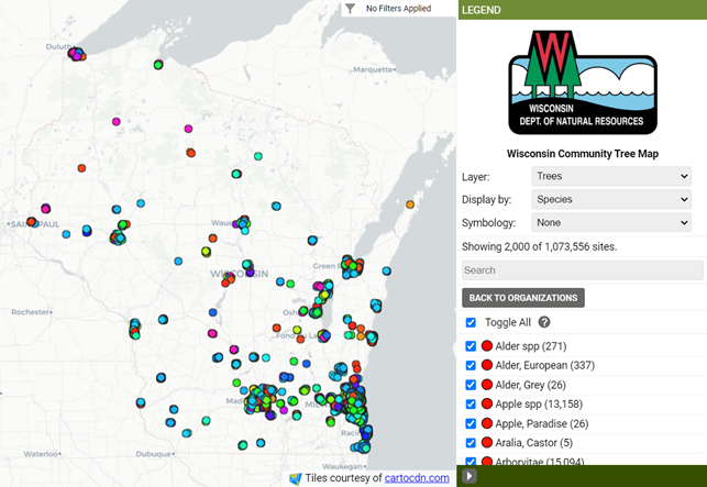 Ever since it launched in 2017, the Wisconsin Community Tree Map has been building a collective inventory of urban trees across the state. Now a milestone has been passed: over one million trees are in the database, giving users an expansive look at much of our urban forest.
Visitors to the tree map, a compilation of tree inventories from over 200 organizations, can use the tool to learn more about their local trees, such as species composition, size distribution, or even some of the ecosystem services those trees provide. Users can filter by certain attributes or areas to further identify trees of interest. Overall, it can be a powerful management, scientific, marketing and educational tool.
Tree inventories are important, even foundational, components of sustainable urban forestry programs. Reaching a million trees in the database indicates the urban forestry community’s recognition of inventories’ value. After all, you must know what you have to make good management decisions.
Today we are celebrating one million trees, though this is not a climax or coda, but an ongoing crescendo. We hope and anticipate that many more inventories are incorporated into the tree map, and that people continue to use the application.
Frequently asked questions about the map are located on the DNR website. If you have an inventory you want to include in the tree map, or you have additional questions about it, please reach out to Daniel.Buckler@wisconsin.gov.