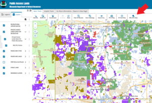
This summer, the DNR rolled out the new Public Access Lands web map. This new web mapping application consolidates various types of public access land information. It also incorporates open Managed Forest Law (MFL) and Forest Crop Law (FCL) properties and replaces the previous Private Forest Lands Open for Public Recreation application. You can learn more about this tool by checking out the press release.
There are a couple of easy steps to follow to view the open MFL and FCL properties. There is also an “MFL/FCL Help” button located on the right side of the top toolbar, if you’re having problems viewing the open MFL/FCL layer.
Good luck this season, and please refer to the open tax law lands page for more information and to find answers to common questions about hunting and access to these properties.