
By Dan Buckler, DNR urban forestry assessment outreach specialist, Madison, Daniel.Buckler@wisconsin.gov, 608-445-4578
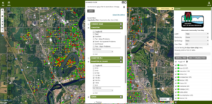
Do you have a tree inventory from the last five years that you’d want to appear on the Wisconsin Community Tree Map, a compilation of tree inventories from around the state? Or perhaps you already have an inventory there, but want to submit an update? Well, there’s no time like the present to get those submitted to the DNR to appear on the map. The tool is a useful way to showcase your community trees, query different groups (e.g. all large ash trees) and contribute to a better understanding of urban forests in Wisconsin.
At a minimum, tree inventories would need to be tracked per tree and include a geographic location (like latitude and longitude), species name, diameter at breast height and, hopefully, health condition. As long as those criteria are met, inventories can be sent as a spreadsheet or GIS file. Any questions or submissions can be sent to DNRUrbanForestryAssessment@wisconsin.gov.