
The USDA Plant Hardiness Zone Map is the standard by which gardeners and growers can determine which perennial plants are most likely to thrive in a given location. The map is based on the average annual extreme minimum winter temperature, displayed as 10-degree Fahrenheit zones and 5-degree Fahrenheit half zones.
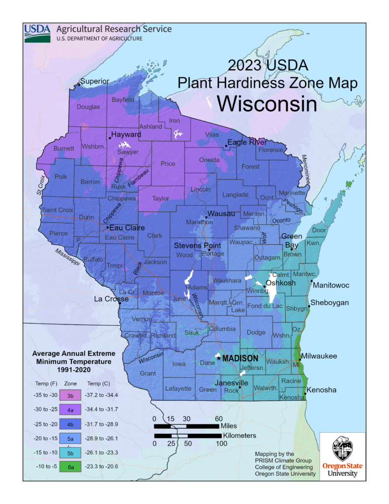 Thirty years of data was reviewed by a group of horticultural, botanical and climatological experts for the latest USDA Plant Hardiness Zone Map revision. This was determined to be the best balance between the fluctuations of year-to-year weather variation and the concept that, during their lifetimes, perennial plants mostly experience what is termed “weather” rather than “climate.” A complex algorithm was used for this edition of the Plant Hardiness Zone Map to enable more accurate interpolation between weather reporting stations. This method accounts for factors such as elevation change and proximity to bodies of water, making mapping zones more accurate.
The updated edition of the Plant Hardiness Zone Map is Geographic Information System-based and is specifically designed for the internet. It enables viewers to examine plant hardiness zones at a much finer scale than earlier maps and includes a ZIP code zone finder for location-based searching. Learn more by visiting the USDA website or exploring the interactive map at 2023 USDA Plant Hardiness Zone Map | USDA Plant Hardiness Zone Map.
USDA Plant Hardiness Zone Map, 2023. Agricultural Research Service, U.S. Department of Agriculture. Accessed from https://planthardiness.ars.usda.gov/