
By Art Kabelowsky, DNR Outreach and Communications, Fitchburg;
Arthur.Kabelowsky@wisconsin.gov or 608-335-0167
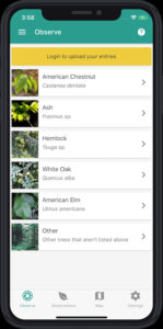
The main page of the TreeSnap app as seen on a mobile phone. / Photo Credit: TreeSnap.org
It takes more than a village to foster healthy forests. More than a township, a city and a county, too. Sometimes, even more than a state.
That’s why the Great Lakes Basin Forest Health Cooperative (GLB FHC) was formed four years ago by Holden Arboretum in Ohio and the U.S. Department of Agriculture Forest Service.
Geographically, the group’s region encompasses an area from New Jersey to Wisconsin. The Wisconsin Department of Natural Resources (DNR) is an active member.
Continue reading “Cooperative Enlists Public To Make Tree Health A Snap”
 Tree City USA Interactive Map
 The trees on school properties mirror those of the surrounding urban forest in composition but not in coverage.
 The Wisconsin Climate and Health Collaborative, a group of climate and health professionals from across the state working to create a healthier climate, people and communities through local action, wants to learn from you and your community! Take this short
 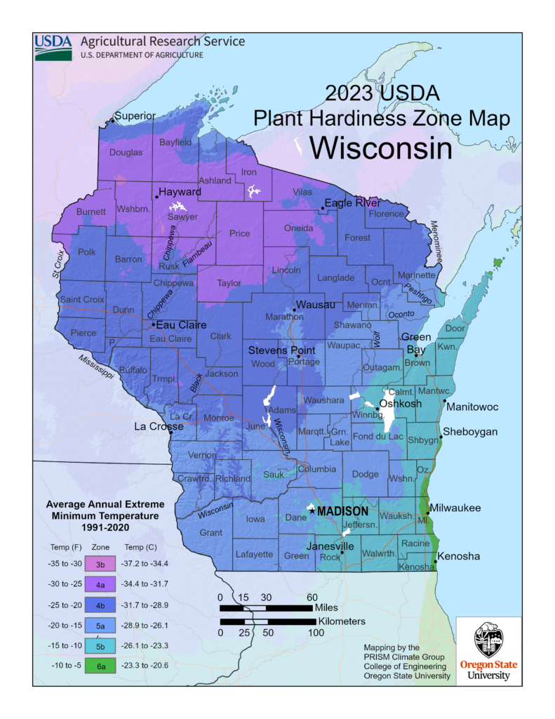 Thirty years of data was reviewed by a group of horticultural, botanical and climatological experts for the latest USDA Plant Hardiness Zone Map revision. This was determined to be the best balance between the fluctuations of year-to-year weather variation and the concept that, during their lifetimes, perennial plants mostly experience what is termed “weather” rather than “climate.” A complex algorithm was used for this edition of the Plant Hardiness Zone Map to enable more accurate interpolation between weather reporting stations. This method accounts for factors such as elevation change and proximity to bodies of water, making mapping zones more accurate.
 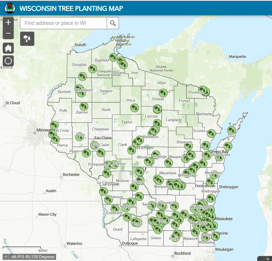 Autumn is a great time to plant trees. After the trees go in the ground, please take a few minutes to document the effort in the